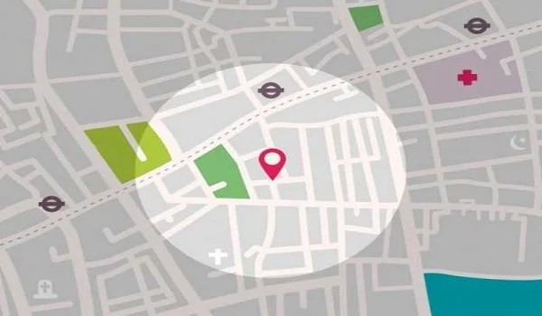
Purva Northern Lights Location
Purva Northern Lights Location is at Plot No. R-12, KIADB Aerospace and Hardware Park, Bagalur, North Bangalore 562149, developed by Puravankara Limited. The site is 10 km from Kempegowda International Airport via NH 44 and 2.5 km from Doddajala Metro Station on the Blue Line. Boeing India and Shell Tech campuses are within the same KIADB park. All 3 phases are RERA-approved, and possession is scheduled for 31 December 2029.
Purva Northern Lights Address

The project is in a neatly planned zone with wide roads and modern infrastructure.
- Exact Location: Plot No. R-12, Hitech, Defense and Aerospace Park, Bagaluru Village, Bengaluru North, Karnataka – 562149.
- Landmark: Inside the KIADB Aerospace & Hardware Park, very close to the Boeing India and Shell Tech campuses.
- Coordinates:
- Latitude: 13.14633609832597
- Longitude: 77.65804585054664
Purva Northern Lights Connectivity Guide 2026

The township sits on 32-meter wide KIADB internal roads with direct access to NH 44. This connects residents to the airport in 15 to 20 minutes and to Manyata Tech Park in 30 minutes. The Doddajala Metro Station at 2.5 km gives a future traffic-free route to Hebbal, KR Puram, and Central Bangalore once the Blue Line is operational.
Air Connectivity

Being near the Kempegowda International Airport (BLR) is a top benefit.
- Distance: ~10 km (Updated: Modern road links have cut this down from older estimates).
- Travel Time: 15-20 minutes via NH 44 (Bellary Road).
- Easy Transit: You can find Vayu Vajra airport buses and 24/7 cabs right at your doorstep.
Metro Connectivity Blue Line

The Namma Metro Blue Line is a major reason for growth in this area.
- Nearest Station: Doddajala Metro Station (just 2-3 km away).
- Alternative: Bagalur Cross Station (3.5 km).
- 2026 Status: Construction is nearly done. This line will soon offer a fast, traffic-free ride to Hebbal, KR Puram, and Silk Board.
Road and Highway Network

Key roads make driving across the city very simple:
- NH 44 (Bellary Road): A massive 6-8 lane highway connecting you to the city center.
- SH 104 (Bagalur Main Road): Your direct route to Yelahanka and East Bangalore.
- STRR (Satellite Town Ring Road): A giant expressway that helps you bypass city traffic to reach other parts of the state.
Rail and Bus Transit

- Yelahanka Railway Station: 12 km (20-25 mins). It is perfect for long-distance travel.
- Hebbal Railway Station: 18 km (30-35 mins).
- Bus Access: The Aerospace Bagalur bus stop is 3 minutes away, with regular buses to major city spots.
Distance from Purva Northern Lights at a Glance
| Landmark | Distance | Estimated Time (Car) |
| KIADB Aerospace SEZ | 0 km (Inside) | 1 Min |
| Doddajala Metro | 2.5 km | 8 Mins |
| Kempegowda Int'l Airport | 10 km | 15–20 Mins |
| Yelahanka New Town | 11 km | 20 Mins |
| Manyata Tech Park | 16 km | 30 Mins |
| Hebbal Flyover | 18 km | 35 Mins |
Places to Visit Near Purva Northern Lights
Purva Northern Lights is located in KIADB Aerospace Park, North Bangalore. The area is close to nature spots, parks, and cultural places. Families, children, seniors, and visitors can enjoy many attractions nearby. These places are good for weekend trips and short outings.
Nandi Hills 28 km from Purva Northern Lights

Nandi Hills is one of most popular tourist places near North Bangalore. It is known for its cool weather and scenic views. People visit early in the morning to enjoy sunrise views. The place is calm and refreshing.
- Timings: 6:00 AM – 6:00 PM
- Entry Fee: Rs. 30 per person
It is ideal for family trips, short drives, and nature lovers.
Lumbini Gardens 17.5 km from Purva Northern Lights

Lumbini Gardens is a lakeside park near Nagavara Lake. It offers boating, water rides, and play areas. Kids enjoy the rides, and adults enjoy the lake views. The park is lively and fun.
- Timings: 11:00 AM – 7:00 PM
- Entry Fee: Rs. 50 per person
It is a good spot for evening visits and family outings.
Jakkur Lake 14 km from Purva Northern Lights

Jakkur Lake is a peaceful place surrounded by greenery. It is popular for morning walks and bird watching. The area is clean and well maintained. Many residents visit daily for exercise and relaxation.
- Timings: Open all day
- Entry Fee: Free
It is a perfect place to relax close to nature.
Devanahalli Fort 18 km from Purva Northern Lights

Devanahalli Fort is a historic site built in the 18th century. It is the birthplace of Tipu Sultan. The fort has wide walls and open spaces. History lovers enjoy visiting this place.
- Timings: 8:00 AM – 5:30 PM
- Entry Fee: Free
It is a calm place to learn about Bangalore’s past.
Hebbal Lake Park 15.5 km from Purva Northern Lights

Hebbal Lake Park is a green space with walking paths and seating areas. It is good for evening walks and family time. The lake attracts birds and nature lovers.
- Timings: 6:00 AM – 6:00 PM
- Entry Fee: Rs. 10 per person
It is a nice place to relax after a busy day.
Elements Mall 13 km from Purva Northern Lights

Elements Mall is a popular shopping as well as entertainment hub. It has stores, restaurants, and a cinema. Families and youngsters enjoy spending time here. It is perfect for shopping and dining.
- Timings: 10:00 AM – 10:00 PM
- Entry Fee: Free
It is a good place for weekends and leisure time.
Why the Location of Purva Northern Lights Matters
North Bangalore's KIADB Aerospace Park is home to Boeing, Airbus, Shell, SAP Labs, and Texas Instruments within a 5 km radius of the project. The area has over 50,000 active professionals working inside the SEZ. That employment base directly drives rental demand and property price growth in this corridor.
A Neighborhood Built by Global Giants
This area is India’s most advanced tech and aerospace zone. It is home to world leaders:
- Engineering: Boeing, Airbus, Collins Aerospace, and Safran-HAL.
- Tech & Research: SAP Innovation Park, Shell Technology Centre, and Texas Instruments.
- Supply Chain: Wipro Aerospace and Thyssenkrupp.
The Tech Corridor of Tomorrow
With over 24 innovation clusters, the region is packed with job hubs:
- KIADB Aerospace & Hardware Park
- L&T Tech Park & Brigade Magnum
- Bhartiya Tech Park & Devanahalli IT Park
Why the Future is North
The KIADB corridor is projected to add over 400,000 high-value jobs, creating sustained demand for quality housing near the project.
- Job Growth: Over 50,000 professionals are already working inside the SEZ at Boeing, Airbus, Shell, and SAP Labs campuses.
- Price Appreciation: Land prices in Bagalur rose 40% between 2021 and 2024. Current rates are ₹7,000 to ₹8,500 per sq.ft, compared to over ₹11,000 per sq.ft in Hebbal.
- Major Investments: iPhone assembly plant worth ₹21,911 Cr and Boeing facility worth ₹2,915 Cr are already operational near the project site.
Why Buy in Bagalur Aerospace Park in 2026
- Price Advantage: While Hebbal costs over ₹11,000/sq. ft., Bagalur is more affordable at ₹7,000 - ₹8,500/sq. ft., offering more room for growth.
- Planned Growth: Unlike crowded city areas, this zone has wide roads and a very organized layout.
- High Rentals: With thousands of experts working nearby, rental demand is strong, offering a 3% - 4.5% yield.
KIADB Aerospace Park North Bangalore

KIADB Aerospace Park is a major development zone in North Bangalore. It is planned and managed by the Karnataka government. The area is clean, wide, and well organized. Many aerospace, defense, and technology companies operate here. The location attracts professionals from across the city. Demand for homes and offices in this zone is rising every year.
KIADB Aerospace Park Connectivity

KIADB Aerospace Park has strong city connectivity. Travel from this area is smooth and simple. The location links well to highways and main roads. Public transport is easy to find. People can reach business hubs without stress. This is one of the key reasons the area is growing fast
KIADB Road Connectivity

Road travel around KIADB Aerospace Park is smooth as well as convenient. The area has wide internal roads, which make daily movement easy. NH 44 connects the park directly to airport and main city areas. SH 104 helps people reach nearby towns and work hubs without delay. STRR helps in fast travel for longer routes. BMTC buses, cabs, and taxis are always available.
Metro Connectivity Near KIADB Aerospace Park

Metro access is a big advantage for this location. The upcoming Airport Metro Blue Line will serve KIADB Aerospace Park. Namma Metro Phase 2B aims to connect Kempegowda International Airport to MG Road. The route is 39 km long. It begins at Krishnarajapura (KR Puram) and passes through the northern part of the Outer Ring Road. It goes via Nagawara, Hebbal, and Jakkur before reaching the airport.
KIADB Airport Connectivity

KIADB Aerospace Park is located close to Kempegowda International Airport. Reaching the airport from here is easy and quick. NH 44 offers a direct and smooth route. The airport is around 10 km away. Travel usually takes about 15 to 20 minutes. This is very helpful for frequent flyers and business travelers.
KIADB Railway Connectivity

Railway connectivity from KIADB Aerospace Park is also good. The area has easy access to nearby railway stations. Roads leading to the stations are well connected. Yelahanka Railway Station is around 12 km away. Hebbal Railway Station is also easy to reach. This makes long-distance travel simple and stress free.
Best Tech Parks Near Purva Northern Lights
Purva Northern Lights is close to major tech and business hubs in North Bangalore. This makes daily travel easy for IT professionals. Many large offices are reachable in a short drive.
- Manyata Tech Park – 18 km
- Kirloskar Tech Park – 16 km
- Bhartiya City Tech Park – 15 km
- Embassy Business Park – 14 km
- RMZ Galleria Tech Park – 13 km
- Devanahalli Business Park – 20 km
Major Hospitals Near Purva Northern Lights
Healthcare access near Purva Northern Lights is very good. Several trusted hospitals are located close by. Emergency and regular care is easy to reach.
- Sparsh Hospital – 8 km
- Narayana Health City – 10 km
- Columbia Asia Hospital, Hebbal – 14 km
- Aster CMI Hospital – 16 km
- Manipal Hospital, Yelahanka – 12 km
Shopping Centres Near Purva Northern Lights
Residents have access to malls and shopping centres within a short drive. Daily needs and entertainment options are easily available.
- RMZ Galleria Mall – 13 km
- Bhartiya Mall of Bengaluru – 15 km
- Elements Mall – 14 km
- Esteem Mall – 16 km
- Orion Mall, Hebbal – 18 km
Schools Near Purva Northern Lights
Many reputed schools are located near the KIADB Aerospace Park area. This makes the location ideal for families with children.
- Stonehill International School – 9 km
- Delhi Public School, North – 12 km
- Vidyashilp Academy – 14 km
- Reva University – 10 km
- Canadian International School – 15 km
Key Distances From Purva Northern Lights to Main Areas
Purva Northern Lights connects well to important parts of North Bangalore. Travel time remains reasonable due to highway access.
- Yelahanka – 12 km
- Hebbal – 18 km
- Devanahalli – 14 km
- Nagawara – 16 km
Purva Northern Lights Bangalore offers 2,973 apartments starting at ₹80 Lakhs at this location inside KIADB Aerospace Park. The combination of airport proximity, metro access, and tech park employment within 5 to 20 km makes this one of the strongest location propositions in North Bangalore in 2026. Possession is December 2029.
Hospitals Within 1.5 km — Immediate Medical Access
Beyond the regional hospital list above (Sparsh, Narayana, Manipal Yelahanka, Aster CMI, Columbia Asia), the project's immediate Bagalur neighbourhood has 5 hospitals within 1.5 km — reachable in under 8 minutes from the Bagalur gate. Three of these are within 1.1 km of the project's main gate, making emergency access faster than at most North Bangalore projects where the nearest hospital is 5+ km away.
| Hospital | Distance | Travel Time | Specialties |
| Dhaara Speciality Hospital | ~0.9 km | 3–5 min | Laparoscopy, ENT, Critical Care |
| Sri Maruthi Hospital | ~1.0 km | 3–5 min | General Medicine, Cardiology, Paediatrics |
| Sparsh Hospital Yelahanka | ~1.1 km | 4–6 min | Orthopaedics, Trauma & Accident Care |
| Shushrusha Hospital | ~1.2 km | 4–7 min | Multi-specialty |
| Apurva Hospital | ~1.3 km | 5–8 min | Accident & Emergency Care, General Consultations |
Emergency note: Sparsh Hospital Yelahanka has a dedicated trauma/accident unit and Dhaara Speciality operates a critical-care unit — both reachable in under 6 minutes from the Bagalur gate.
FAQS
1.What is the exact address of Purva Northern Lights?
The project address is Plot No. R-12, Hitech Defense and Aerospace Park, Bagaluru Village, Bengaluru North, Karnataka 562149. It is inside the KIADB Aerospace and Hardware Park, close to the Boeing India and Shell Tech campuses. GPS coordinates are 13.1463 N, 77.6580 E.
2.How far is Purva Northern Lights from Kempegowda International Airport?
The airport is approximately 10 km from the project via NH 44. Travel time is 15 to 20 minutes by road. Vayu Vajra airport buses and 24/7 cab services are available near the project. This makes it one of the closest RERA-approved residential townships to Bangalore airport in 2026.
3.Which metro station is closest to Purva Northern Lights?
Doddajala Metro Station on the Blue Line is 2.5 km from the project, about 8 minutes by road. Bagalur Cross Station is the alternative at 3.5 km. The Blue Line connects to Hebbal, KR Puram, and Silk Board. Construction of this line is nearing completion as of 2026.
4.What tech parks are within 20 km of Purva Northern Lights?
RMZ Galleria Tech Park is 13 km away, Embassy Business Park is 14 km, Bhartiya City Tech Park is 15 km, Kirloskar Tech Park is 16 km, and Manyata Tech Park is 18 km. For aerospace professionals, the Boeing India and Shell campuses are within the same KIADB park as the project.
5.What is the RERA number and possession date for Purva Northern Lights?
Phase 1 is registered as PRM/KA/RERA/1251/309/PR/120326/008523. Phase 2 and Phase 3 are registered under 008524 and 008525. All 3 phases received Karnataka RERA approval on 12 March 2026. Possession for Phase 1 is targeted for December 2029.
6.Is Purva Northern Lights a good location for investment in 2026?
Property rates in KIADB Aerospace Park range from ₹7,000 to ₹8,500 per sq.ft compared to over ₹11,000 per sq.ft in mature zones like Hebbal. Rental yields in this corridor are 3% to 5.1%. With the metro, STRR, and major aerospace investments nearby, the location has strong short and long-term appreciation potential.
7.What is the closest hospital to Purva Northern Lights?
The closest hospital is Dhaara Speciality Hospital at approximately 0.9 km from the project gate — reachable in 3–5 minutes by road. It handles Laparoscopy, ENT, and Critical Care. Three other hospitals (Sri Maruthi at 1.0 km, Sparsh Yelahanka at 1.1 km, and Shushrusha at 1.2 km) are all within 1.5 km and reachable in under 7 minutes.
8.How long does it take to reach a hospital in an emergency from Purva Northern Lights?
Emergency hospital access is under 6 minutes by road. Sparsh Hospital Yelahanka (1.1 km, 4–6 min) operates a dedicated trauma and accident unit; Dhaara Speciality (0.9 km, 3–5 min) runs a critical-care unit. For tertiary care — major cardiac surgery, organ transplant, oncology — Manipal Hospital Hebbal (7.5 km, 18–25 min) and Narayana Health City (10 km, 20–24 min) are reachable via NH-44.
More on Location
Explore the other location pages on this site for layouts, comparisons and buyer considerations:
- 2 BHK Flats for sale near Aerospace
- check the 3 BHK apartments near the International Airport
- explore 4 BHK luxury flats near Kempegowda Airport
- Mega-Township That Is Changing How North
- Address
- Aerospace Park Connectivity Analysis
- Air Quality & Noise Levels -What Residents Can Expect
- Bagalur Airport and Map
- Location Risk Analysis
Purva Northern Lights Blog


 Whatsapp